Typhoon NIDA (26W) (26W) CAT 1---12PM Dec 01: 20.4N 137.9E 140 kph NW @ 05 kph Western Pacific
Posted: December-01-2009
in
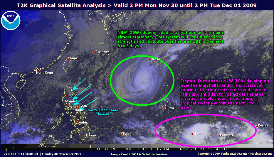
Typhoon NIDA continues to weaken as it moves slowly northwestward.
*Cooler dry air, increasing upper-level winds (aka. Vertical Wind Shear) and slightly lower sea surface temperatures are the ones that contribute for the weakening of NIDA.
*Do not use this for life or death decision. This advisory is intended for additional information purposes only. Kindly refer to your country's official weather agency for local warnings, advisories & bulletins.
Current Storm Information
Time/Date: 12:00 PM PST Tue Dec 01 2009
Location of Eye: 20.4º N Lat 137.9º E Lon
Distance 1: 600 km (323 nm) SW of Iwo To
Distance 2: 300 km (162 nm) East of P.A.R.
Distance 3: 1,655 km (893 nm) East of Batanes, PH
MaxWinds (1-min avg): 140 kph (75 kts) near the center
Peak Wind Gusts: 165 kph (90 kts)
6-hr Rain Amounts (near the center): 250 mm [Heavy]
Minimum Central Pressure: 967 millibars (hPa)
Saffir-Simpson Typhoon Scale: Category 1
Present Movement: NW @ 05 kph (03 kts)
Towards: Western Pacific Ocean
Size (in Diameter): 760 km (410 nm) / Large
Max Sea Wave Height (near center): 30 ft (9.1 m)
Coastal Storm Surge Height: 4-5 feet [1.2-1.7 m]
Forecast Outlook: NIDA is expected to continue moving WNW and weaken fast within the next 2 days. This system will be downgraded into a Tropical Storm tomorrow morning as cold dry air, increasing upper level winds and cooler sea surface temperatures enters and affects its circulation. It will then weaken into a depression while recurving towards the NE on Thursday morning (8AM Dec 03: 23.4N 136.2E). The 2 to 3-day Medium-Range Forecast shows the system becoming an Extratropical Cyclone while accelerating NE-ward on Friday morning (8AM Dec 04: 27.8N 140.8E). This recurvature scenario is due to an appoaching middle-latitude low pressure (aka. frontal system) digging from the north. Please be reminded that the Forecast Outlook changes every 6 hours, so a turn to the left or right of its future track and other possibilities must be considered.
+ Effects & Hazards: NIDA is not affecting any major islands at this time. 6-hr total rainfall amounts of 5 up to 100 mm (light to moderate rain) can be expected along the outer and inner bands...with isolated amounts of 250 mm (heavy rain) just north of NIDA's ill-defined Eye or along the Northern EyeWall. Click here to view the latest NOAA's eTRaP graphic on the storm's rainfall amount.
+ Current NE Monsoon Intensity: MODERATE >> Mostly cloudy skies with passing occasional rains and squalls (subasko) can be expected along the following affected areas: EASTERN LUZON, BICOL REGION, MASBATE AND NORTHERN VISAYAS. Light to moderate northeasterly winds (not in excess of 40 kph) can be expected on these areas.
- Login to post comments
- 6097 reads
- Printer-friendly version